info@pelicangeographics.com
+44 (0)1730 302039

Mobile Tools
Mobile Geospatial Solutions
With the advance of mobile phones and mobile data collection devices, everyone can now use GIS on-the-move via one of the many tools available.
Spectrum Spatial and DataSight
are cross-platform, viewed via web browsers.
Konect
is an enterprise solution, with an iOS and Android app for installation on mobile devices.
Discover Mobile
is an Android-based app activated with a valid Discover maintenance contract, and is available from Google Play Store.
GBM Mobile and GBM Portable
are legacy products, now fully catered for within Konect.
The solutions fully integrate with both office and data centre based operations, on either a departmental or enterprise scale.
Pelican GeoGraphics is partnered with the developers of these tools. Links are generally to the developer sites, but please contact us with any questions.
Quickly gain location-based insights and easily communicate with your audience.
More Info >>
SSA is a web-based Location Intelligence platform enabling users to view and, if required, edit spatial data directly in the browser on any mobile or desktop device. It can be accessed on either an intranet for employees, or the web for customers, citizens and other key stakeholders.
Integration with MapInfo Pro makes it easy for the GIS administrator to set up maps and map views for non-specialists.

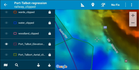
Konect is an enterprise solution to connect all your workers and data, via desktop, internet and mobile device.
Konect is a map-driven business tool which improves:
- Workforce mobility
- Business workflow
- Project and task allocation
- Field data collection and capture online and offline
- Team integration and automation
- Real time performance monitoring
If you have a mobile workforce and need to share data between devices and people, Konect will work for you. Users include:
- Local Government
- Agriculture
- Delivery
- Communitcations
- Telco
- Environmental
- Exploration
Managed via desktop, Konect enables your workforce to stay in touch, with access to all the data they require via any device, on any platform.
Konect is COTS (Commercial Off The Shelf) meaning it’s ready to go with no in-house programming required. Just download Konect & you’re ready to go.
Konect’s powerful Manager desktop allows you to quickly build customised forms with the WSIWYG (What You See Is What You Get) emulator or you can import forms.
Konect’s power is its ability to work across a range of departments in the one organisation or with sub-contractors. Data is easily shared across a single, robust and simple to use platform.
Konect is also the only mobile device solution available that is truly GIS agnostic That means you can import data to and from any platform including MapInfo, ESRI, GeoJSON and more.
Konect manages all GIS object types. Use the free base maps or those from other corporate or public sources. Import your own data or create it on the go.


Global GBM Mobile
- Windows-based (legacy only - full functionality available in Konect)
Streamline MapInfo .TAB data collection on a mobile device for error-free data collection.
Features include:
- Mapping Toolbox - View, pan and zoom maps; draw and edit MapInfo objects; measure, info and statistics tools; assign graphical styles
- GPS-integration - Draw at GPS location, allow a moving map, track GPS routes
- Customised Forms - build your data entry forms on base PC for use by your field worker to enable data validation, style libraries, pick lists, track changes and more
- Fully integrated with MapInfo Professional (desktop), allowing transfer of data between mobile device and office-based systems directly via cable, wireless network or by mobile phone
- GBM Mobile Manager - PC-based user interface for automated transfer of software, data and custom forms between PC and mobile device. User profiles automate upload and download operations for field workers.
- GBM Mobile Merge - Automate merging of field edits, time stamp changes, support multiple field operators, resolve concurrent edits and easily synchronise data between PC and mobile devices.
Runs on a Windows-based PDA. Mobile Merge requires MapInfo 32-bit
Global GBM Portable
- Windows Based (legacy only - full functionality available in Konect)
GBM Portable is part of the Global GBM Mobility Suite, and is the ideal system for mobile operators who prefer a Windows computer to a PDA. It also provides an office solution that parallels the GBM Mobile field environment.
GBM Portable supports full GIS mapping, GPS integration and the same custom forms capability as GBM Mobile. It operates on Windows desktop, notebook and tablet PCs.
GBM Portable has an easy-to-use interfaces which assists project supervisors to tailor maps and information display. End user training overheads are very low.
With all the tools and functionality of GBM Mobile but on a bigger screen.
Runs on a Windows-based tablet. Mobile Merge requires MapInfo 32-bit


Global GBM Specialist Tools (legacy only - full functionality available in Konect)
Global GBM have developed a suite of tools for collection of MapInfo-based spatial data, which are maintained via desktop and viewed / edited via web browser or mobile device.
Data is collected in custom-built forms similar to the GBM Mobile forms, collecting uniform data via pick-lists to avoid errors.
Global GBM have developed out-of-the-box tools specifically for:
Tailored solutions can be developed for:
- Graffiti management
- Compliance management
- Disaster management
- Works management
Discover Mobile
for Android
The new Discover Mobile 2019 is a desktop-integrated Android app for the field geologist, and is provided free of charge to all Discover users while they have a valid maintenance contract.
Ease of Flow Between Office and Field:
- Designed to assist with the seamless flow of data between the field and the office from enterprise source data to desktop to the field and back again
Visualisation of GIS Layers in the Field:
- Take all your GIS data into the field - image, grid and point, line and polygon. Interrogate values of your vector data to compare with your own field observations
Waypoint Navigation:
- Navigate to your next sample or point of interest using the waypoint navigation tool. An alarm will sound once you arrive at the location.
Data Collection:
- You can collect point and line data, as well as attribute data using dropdown lists to help data consistency and ease of logging.


Info
info@pelicangeographics.com
Phone: +44 (0)1730 302039